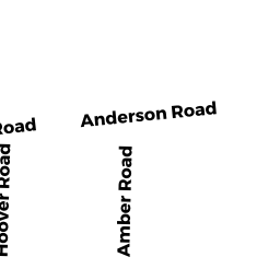
6 ANDERSON ROAD
Owner Information
AVIZONIS PETRAS VYTAUTAS & AUDRA J
6 ANDERSON ROAD
HINGHAM, MA 02043


Property Details
6 ANDERSON ROAD is classified as a Single Family Residential (Colonial).
The primary structure on this property was built in 1965. There are 4,883ft2 of built area within this property. There is 2,950ft2 of residential/living space within this property. This property is listed as having 9 rooms.
6 ANDERSON ROAD is valued at $905,700. The land is valued at $425,200 and the structures are valued at $447,000. There is an additional valuation of $33,500 on this property.
This property is in Zone RB. Confirm with local Zoning Board authorities to ensure there are no overlays or other easements on this property.
The most recent deed for 6 ANDERSON ROAD is recorded at the local registrar in Book 38654, Page 0028. 6 ANDERSON ROAD was last sold on Wednesday, June 23, 2010 for $766,500.
Assessment data from fiscal year 2022.
Flood Data
According to the FEMA National Flood Hazard Layer, this property does not appear to be in a flood zone. It may also be in an area not yet reviewed. Nonetheless, confirm this information prior to taking any action.
To view the flood hazards around this property, create a FEMA "Firmette" Map of the area around 6 ANDERSON ROAD.
Broadband Internet Providers
| Provider | Type | Bandwidth (mbps) | |
|---|---|---|---|
| GCI Communication Corp. | Satellite | 0 | 0 |
| T-Mobile | Fixed Wireless | 25 | 3 |
| Comcast | Cable | 1000 | 35 |
| Viasat Inc | Satellite | 100 | 3 |
| Verizon New England Inc. | Fiber | 940 | 880 |
| Verizon New England Inc. | DSL | 5 | 0 |
| HughesNet | Satellite | 25 | 3 |
| VSAT Systems, LLC. | Satellite | 2 | 1 |
Broadband service provider data from December 2020.
Adjacent Properties
- 0 SO PLEASANT ST
Buildings for manufacturing operations owned by WRWS/TOWN OF HINGHAM - 0 CHARLES STREET
Vacant, Conservation (Municipal or County) owned by TOWN OF HINGHAM - 4 ANDERSON ROAD
Single Family Residential owned by DAVEY IAN EDWARD & CAROLINE EMERSON - 0 CHARLES STREET
Vacant, Conservation (Municipal or County) owned by TOWN OF HINGHAM REFORESTATION